


Preview
Identifier
20086325
Description
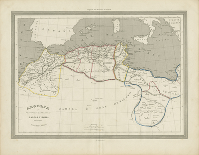
Uncolored map showing Northern Africa in the mid-19th century. Includes surrounding regions of Spain and southern Italy. Territories within regions of Northern Africa are divided by hand colored boundaries. Legend in Spanish and distance measured in Roman miles located at bottom beside title of map. Double-paged, single-sided, horizontal map bound at centerfold on verso. 24 cm. x 32 cm. [Gift of Dr. Jack Franke]
Archival Date
1855
Collection Name
Maps of Africa
Collection Number
Acc. 2019-357
Language
Spanish
Original Format
Maps
File Format
JPG
Rights
Rights held by The University of Texas at Arlington Libraries, Special Collections. Any use of content downloaded or printed from this page is limited to non-commercial personal or educational use, including fair use as directed by U.S. copyright laws. For more information or for reproduction requests, please contact UTA Special Collections by emailing spcoref@uta.edu.
License

This work is licensed under a Creative Commons Attribution-NonCommercial 4.0 International License
Subjects
Maps; Africa; Deserts; Seas; Waterways; Mountains