


Preview
Identifier
20086479
Description
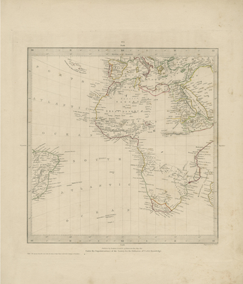
Uncolored map of Africa with portions of Brazil, Mediterranean, Arabia, and southern Europe included. Some regions distinguished by colored outlines within African coasts and surrounding regions of Mediterranean, Brazil, and Arabia. Major landforms are identified throughout African continent. Border surrounding map includes scale. Publisher information located within bottom margin. Single-paged, single-sided, vertical map. 40 cm. x 34 cm. [Gift of Dr. Jack Franke]
Archival Date
1832
Collection Name
Maps of Africa
Collection Number
Acc. 2019-402
Language
English
Original Format
Maps
File Format
JPG
Rights
Rights held by The University of Texas at Arlington Libraries, Special Collections. Any use of content downloaded or printed from this page is limited to non-commercial personal or educational use, including fair use as directed by U.S. copyright laws. For more information or for reproduction requests, please contact UTA Special Collections by emailing spcoref@uta.edu.
License

This work is licensed under a Creative Commons Attribution-NonCommercial 4.0 International License
Subjects
Maps; Africa; Africa--Maps; Brazil; Mediterranean Sea; Europe