


Preview
Identifier
20086476
Description
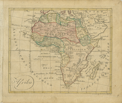
Map of Africa published by Johannes Walch in his rare "Allgemeiner Atlas Nach den bewährsten Hülfsmitteln und astronomischen Ortsbestimungen...," edition of 1812. Regions are distinguished and outlined by color with lightly colored shading. Horizontal orientation. Single paged, single sided. 18 cm. x 22 cm. [Gift of Dr. Jack Franke]
Archival Date
1812
Collection Name
Maps of Africa
Collection Number
Acc. 2019-308
Language
German
Original Format
Maps
File Format
JPG
Rights
Rights held by The University of Texas at Arlington Libraries, Special Collections. Any use of content downloaded or printed from this page is limited to non-commercial personal or educational use, including fair use as directed by U.S. copyright laws. For more information or for reproduction requests, please contact UTA Special Collections by emailing spcoref@uta.edu.
License

This work is licensed under a Creative Commons Attribution-NonCommercial 4.0 International License
Subjects
Maps; Africa; Deserts; Oceans; Waterways