


Preview
Identifier
20086323
Description
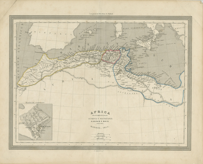
Uncolored map of African continent, as known during mid-19th century. Includes the surrounding islands of mainland. Surrounding regions of Arabia and the Mediterranean are included. Lack of detail presented within Central Africa. Continent is depicted generally with coastal regions of interests, outlined by color. Title is located in bottom left and scale is located at bottom right. Some mountain ranges and rivers depicted, including Mountains of Kong visible near modern-day Burkina Faso. Enderby Land is displayed below Africa. Double-page, single-sided, vertical map bound at centrefold. 35 cm. x 24 cm. [Gift of Dr. Jack Franke]
Archival Date
1852
Collection Name
Maps of Africa
Collection Number
Acc. 2019-358
Language
Spanish
Original Format
Maps
File Format
JPG
Rights
Rights held by The University of Texas at Arlington Libraries, Special Collections. Any use of content downloaded or printed from this page is limited to non-commercial personal or educational use, including fair use as directed by U.S. copyright laws. For more information or for reproduction requests, please contact UTA Special Collections by emailing spcoref@uta.edu.
License

This work is licensed under a Creative Commons Attribution-NonCommercial 4.0 International License
Subjects
Maps; Africa; Seas; Waterways; Islands; Mountains