


Preview
Identifier
20086439
Description
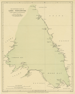
Map of the southern portion of Lake Tanganyika, the second largest lake in the world, first discovered by Richard Burton and John Speeke in 1858. Single paged. 46 cm. x 21 cm. [Gift of Dr. Jack Franke]
Archival Date
1882
Collection Name
Maps of Africa
Collection Number
Acc. 2019-356
Language
English
Original Format
Maps
File Format
JPG
Rights
Rights held by The University of Texas at Arlington Libraries, Special Collections. Any use of content downloaded or printed from this page is limited to non-commercial personal or educational use, including fair use as directed by U.S. copyright laws. For more information or for reproduction requests, please contact UTA Special Collections by emailing spcoref@uta.edu.
License

This work is licensed under a Creative Commons Attribution-NonCommercial 4.0 International License
Subjects
Maps; Africa; Lakes; Great lakes (Africa); Lake Tanganyika