


Preview
Identifier
20086383
Description
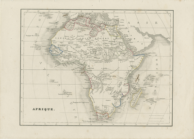
Uncolored map of Africa as known in the mid-19th century. Some coastal regions delineated by color. Hachures depicted along the coast and landforms located throughout map. Title located at bottom left. Border surrounding map includes scale. Incomplete key of scale in lower right corner. Single-paged, single-sided, horizontal map. 21 cm. x 27 cm. [Gift of Dr. Jack Franke]
Archival Date
1838
Collection Name
Maps of Africa
Collection Number
Acc. 2019-332
Language
French
Original Format
Maps
File Format
JPG
Rights
Rights held by The University of Texas at Arlington Libraries, Special Collections. Any use of content downloaded or printed from this page is limited to non-commercial personal or educational use, including fair use as directed by U.S. copyright laws. For more information or for reproduction requests, please contact UTA Special Collections by emailing spcoref@uta.edu.
License

This work is licensed under a Creative Commons Attribution-NonCommercial 4.0 International License
Subjects
Maps; Africa; Seas; Waterways; Oceans