


Preview
Identifier
20086377
Description
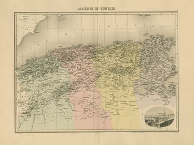
An attractive, hand coloured map of Algeria and Tunisia, published in J. Migeon's 'Nouvel Atlas Illustre Geographie Universelle,' in Paris in 1891. The map is titled 'Algerie et Tunisie' and includes a vignette of Algiers. 39 cm. x 53 cm. Accompanied by two pages of French text. [Gift of Dr. Jack Franke]
Archival Date
1880
Collection Name
Maps of Africa
Collection Number
Acc. 2019-268
Language
French
Original Format
Maps
File Format
JPG
Rights
Rights held by The University of Texas at Arlington Libraries, Special Collections. Any use of content downloaded or printed from this page is limited to non-commercial personal or educational use, including fair use as directed by U.S. copyright laws. For more information or for reproduction requests, please contact UTA Special Collections by emailing spcoref@uta.edu.
License

This work is licensed under a Creative Commons Attribution-NonCommercial 4.0 International License
Subjects
Maps; Africa; Rivers; Mountains; Tunisia; Algeria; Vignettes