


Preview
Identifier
metapth231503
Description
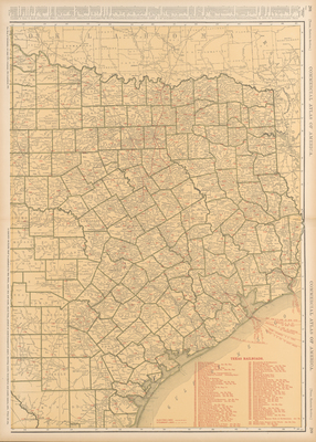
The two maps, the Eastern and Western halves of Texas, were originally published in the popular Rand McNally Commercial Atlas of Texas. Similar maps were produced for other states in the atlas. The Texas Eastern Sheet includes a printed list of Texas railroads in service at the time. In addition, they are indexed on the map as well. At the time this atlas was produced, the railroads were the major shippers of goods and people and provided considerably more information for business people than did the early road maps The back of the maps list an index of towns along with population statistics from the 1920 census.
Archival Date
1921
Location
130/1
Collection Name
Cartographic Connections
Collection Number
00757a
Publisher
University of Texas at Arlington Libraries
Original Format
Map
File Format
JPG
Rights
Any use of content downloaded or printed from this site is limited to non-commercial personal or educational use, including fair use as directed by U.S. copyright laws. For more information or for reproduction requests, please contact Special Collections
Subjects
Texas
Item Type
image
Names
Rand McNally & Co.
Subjects
Texas