


Preview
Identifier
metapth231320
Description
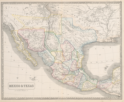
This map was produced by British mapmaker George Phillips of Liverpool, England, shortly after the United States’ War with Mexico, 1846-1848. The map was created for a British public interested in the United States, Texas, and Mexico. It is important to point out that the British tried to convince Mexico to recognize the Republic of Texas to prevent Texas’s annexation to the United States. The British hoped to keep Texas independent so that it would serve as a barrier to further United States westward expansion in the 1840s and be a dependable alternate supplier of cotton for British manufacturers. The annexation of Texas to the United States in 1845 ended these British hopes, but did not end British interest in the region. This commercially produced map was aimed at a British public eager for news of the United States and its southern neighbor. [Gift of Virginia Garrett]
Archival Date
1853
Location
133/9
Collection Name
Cartographic Connections
Collection Number
00282
Publisher
University of Texas at Arlington Libraries
Original Format
Map
File Format
JPG
Rights
Any use of content downloaded or printed from this site is limited to non-commercial personal or educational use, including fair use as directed by U.S. copyright laws. For more information or for reproduction requests, please contact Special Collections
Subjects
Texas; Mexico
Item Type
image
Names
Phillip, George (1800-1882)
Subjects
Texas; Mexico