


Preview
Identifier
metapth193416
Description
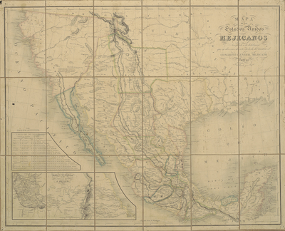
In addition to a map of Texas for his 1835 atlas, Boston editor and publisher Thomas Gamaliel Bradford (1802-1887) issued another larger map of the new republic in vertical format for his larger and more elaborate atlas of 1838. Boston engraver G. W. Boynton engraved the newer map. It corrected and updated some of the older information, such as, for examples: what was formerly “Goliod” is now correctly spelled “Goliad,” Cole’s Settlement is now the town of Washington; the towns of Corpus Christi, Houston, Electra, and others have been added as have the Coushatta and Alabama Indian villages in the east; and the northeast boundary with Arkansas and Louisiana has been corrected to reflect, for the most part, its current configuration. By outline and, in this version also by color, Bradford continued to show the old Mexican land grants rather than the republic’s new counties. In his lengthy text accompanying the map he conceded that “the boundaries of this infant commonwealth are as yet unsettled on the side of Mexico” but the newer map includes the mouth of the Rio Grande; moreover, other examples of Bradford’s 1838 map nevertheless depict the Rio Grande as the boundary through original outline color suggesting perhaps Bradford may have had a different, more pro-Texas audience in mind.[Gift of Murray Hudson]
Archival Date
1837
Location
80/5
Collection Name
Cartographic Connections
Collection Number
2003-518
Publisher
University of Texas at Arlington Libraries
Original Format
Map
File Format
JPG
Rights
Any use of content downloaded or printed from this site is limited to non-commercial personal or educational use, including fair use as directed by U.S. copyright laws. For more information or for reproduction requests, please contact Special Collections
Subjects
Mexico; Texas; United States
Item Type
image
Subjects
Mexico; Texas; United States