


Preview
Identifier
metapth190654
Description
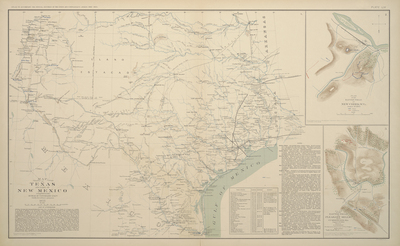
Although not published until 1891-1895, this map of Texas and New Mexico was based upon information compiled by the U.S. Army Corps of Topographical Engineers by 1857. From 1862 in manuscript form, Union General N. P. Banks, commander of the Union Department of the Gulf, utilized it for planning and military operations. Not surprisingly, there is a wealth of militarily important information here: forts and military camp locations, river crossings, and navigation notes, local crops, and water. Exploration, survey routes, and travel problems are identified along with two inset battleplans.
Archival Date
1857
Location
63/11
Collection Name
Cartographic Connections
Collection Number
95-2
Publisher
University of Texas at Arlington Libraries
Original Format
Map
File Format
JPG
Rights
Any use of content downloaded or printed from this site is limited to non-commercial personal or educational use, including fair use as directed by U.S. copyright laws. For more information or for reproduction requests, please contact Special Collections
Subjects
Texas; New Mexico
Item Type
image
Names
United States Army Bureau of Topographic Engineers
Subjects
Texas; New Mexico