


Preview
Identifier
metapth231273
Description
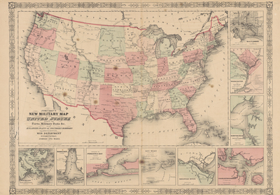
On April 12, 1861, defiant southern soldiers fired on a federal naval force sent to provision Fort Sumter, a federal naval force sent to position Fort Sumter, a federal fort in Charleston Harbor. As a result of these shots and the increasing hostility between the northern and southern states, the U. S. descended into Civil War, a war that would last for four years. This map by one of the U. S.’s leading map publishers, Johnson, was produced shortly after the war’s outbreak and focuses on the forts, military posts, and harbors in the U. S. Titling the map a “New Military Map,” Johnson hoped to capitalize on the country’s interest in the war an interest that would produce market for maps, photographs, new papers, and other products about the war. [Gift of Virginia Garrett]
Archival Date
1861
Location
136/9
Collection Name
Cartographic Connections
Collection Number
00162
Publisher
University of Texas at Arlington Libraries
Original Format
Map
File Format
JPG
Rights
Any use of content downloaded or printed from this site is limited to non-commercial personal or educational use, including fair use as directed by U.S. copyright laws. For more information or for reproduction requests, please contact Special Collections
Subjects
United States
Item Type
image
Names
Johnson & Ward
Subjects
United States