


Preview
Identifier
metapth231250
Description
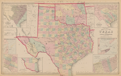
Gray’s New Map of Texas and the Indian Territory shows Texas near the end of Reconstruction. It includes seven inset maps that document the rivers of Texas and their tributaries, a “Hypsometric Sketch of Texas” that depicts the topography, the entrances to Galveston Bay and to Matagorda Bay, a map of Austin, and the southern tip of Texas.
Archival Date
1876
Location
136/4
Collection Name
Cartographic Connections
Collection Number
00113
Publisher
University of Texas at Arlington Libraries
Original Format
Map
File Format
JPG
Rights
Any use of content downloaded or printed from this site is limited to non-commercial personal or educational use, including fair use as directed by U.S. copyright laws. For more information or for reproduction requests, please contact Special Collections
Subjects
Texas; Indian Territory
Item Type
image
Names
Gary, Frank A. (1852-1886)
Subjects
Texas; Indian Territory