


Preview
Identifier
metapth193703
Description
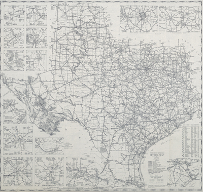
Modern road, or highway maps, emerged with the development of the automobile in the early twentieth century. Although earlier maps did depict wagon and other roads, the first automobile map for automobile drivers was produced in 1904 before the first Model-T rolled off the production lines or concrete roadways became common after about 1910. The Federal Aid Road Act of 1916 and the establishment of United States Highway Routes in 1925 solidified the "car culture" and the maps that were produced to facilitate this defining element in American society. This 1945 map was mass-produced by the Texas Highway Department to promote the state of Texas. Produced at the end of World War II when resources were scarce, the map is printed only in black and white. The back of the map is blank unlike highway maps produced before the war, which had elaborate promotional literature printed in four colors. A few years later, the highway maps again will reflect the booming economy of post-war America.
Archival Date
1945
Location
92/10
Collection Name
Cartographic Connections
Collection Number
91-1622
Publisher
University of Texas at Arlington Libraries
Original Format
Map
File Format
JPG
Rights
Any use of content downloaded or printed from this site is limited to non-commercial personal or educational use, including fair use as directed by U.S. copyright laws. For more information or for reproduction requests, please contact Special Collections
Subjects
Texas
Item Type
image
Names
Texas Highway Department
Subjects
Texas