


Preview
Identifier
20157059a
Description
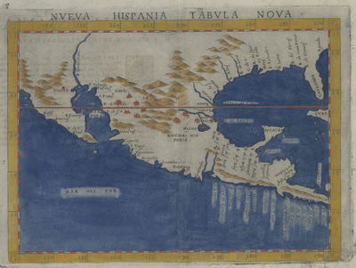
This colorful sixteenth-century map of southern North America (or “New Spain” as the Spanish named it) already exhibits the general shape of southern North America. Texas would eventually comprise the far northeastern portion of New Spain. The map was originally one of the “new” maps produced to augment a Venetian edition of the second-century Greek scholar Claudius Ptolemy’s famous Geography which by the time of the European age of discovery had been found inadequate for coverage of many parts of the world
Archival Date
1574
Location
128/12
Collection Name
Cartographic Connections
Collection Number
2018-353
Publisher
University of Texas at Arlington Libraries
Original Format
Map
File Format
JPG
Rights
Any use of content downloaded or printed from this site is limited to non-commercial personal or educational use, including fair use as directed by U.S. copyright laws. For more information or for reproduction requests, please contact Special Collections
Subjects
New Spain; Mexico
Item Type
image
Names
Ruscelli, Girolamo (1518-1566)
Subjects
New Spain; Mexico