


Preview
Identifier
20189715
Description
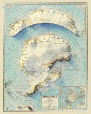
Muir Way created this 3D illusion map by applying modern digital elevation data and relief shading to an original 20th century map of Antarctica. The original map was produced in 1939 by the Department of the Interior, Canberra, Australia, to define Australia’s newly declared Antarctic Territory. This 2026 version of the map is an example of how modern GIS data can be applied to historic maps to reveal past understandings and create new insights.
Archival Date
1939 (2026)
Collection Name
Antarctica Maps
Collection Number
2026-485
Publisher
University of Texas at Arlington Libraries
File Format
JPG
Rights
Any use of content downloaded or printed from this site is limited to non-commercial personal or educational use, including fair use as directed by U.S. copyright laws. For more information or for reproduction requests, please contact Special Collections at The University of Texas at Arlington Libraries by emailing [email protected]
Subjects
Antarctica; South Pole
Item Type
image
Names
Muir Way; Department of the Interior, Canberra, Australia
Subjects
Antarctica; South Pole