Follow
Advanced Search
Contact the MavMatrix Accessibility Coordinator if you require an accessible and/or alternative version of the file available with any item.


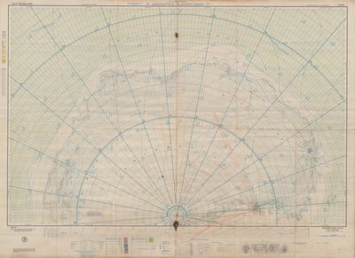
![U.S. Air Force Aeronautical Planning Chart (AP-42) Wilkes Land [annotated from Byrd's flight over Antarctica] by Richard E. Byrd and Aeronautical Chart and Information Center](https://mavmatrix.uta.edu/specialcollections_antarcticamaps/1457/thumbnail.jpg "U.S. Air Force Aeronautical Planning Chart (AP-42) Wilkes Land [annotated from Byrd's flight over Antarctica] by Richard E. Byrd and Aeronautical Chart and Information Center")
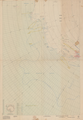
![Air Navigation Chart No V30-SP5 [annotated from Byrd's flight over Antarctica] by Richard E. Byrd and U.S. Navy Hydrographic Office](https://mavmatrix.uta.edu/specialcollections_antarcticamaps/1458/thumbnail.jpg "Air Navigation Chart No V30-SP5 [annotated from Byrd's flight over Antarctica] by Richard E. Byrd and U.S. Navy Hydrographic Office")
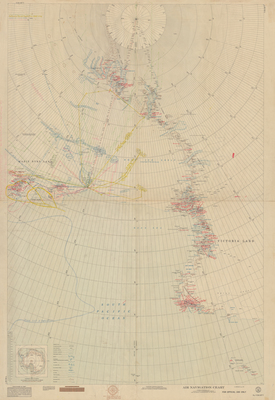
![Air Navigation Chart No V30-SP7 [annotated from Byrd's flight over Antarctica] by Richard E. Byrd and U.S. Navy Hydrographic Office](https://mavmatrix.uta.edu/specialcollections_antarcticamaps/1459/thumbnail.jpg "Air Navigation Chart No V30-SP7 [annotated from Byrd's flight over Antarctica] by Richard E. Byrd and U.S. Navy Hydrographic Office")


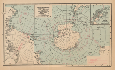
![Region Around the South Pole, Showing Major Explorations 1928 - 1934 / Ross Sea Area Showing Byrd's South Polar Flight [from Hammond's Modern Illustrated Atlas of the World] by C.S. Hammond & Co.](https://mavmatrix.uta.edu/specialcollections_antarcticamaps/1393/thumbnail.jpg "Region Around the South Pole, Showing Major Explorations 1928 - 1934 / Ross Sea Area Showing Byrd's South Polar Flight [from Hammond's Modern Illustrated Atlas of the World] by C.S. Hammond & Co.")


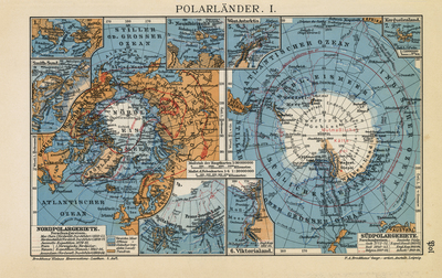
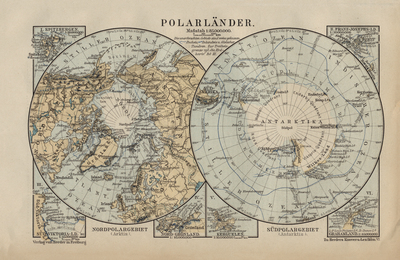
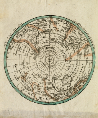
![Nordpolargebiete [and] Südpolargebiete by F.A. Brockhaus](https://mavmatrix.uta.edu/specialcollections_antarcticamaps/1420/thumbnail.jpg "Nordpolargebiete [and] Südpolargebiete by F.A. Brockhaus")


. by Frederick Warne & Co.")


![Polar Regions [verso] South America South by George Philip & Son](https://mavmatrix.uta.edu/specialcollections_antarcticamaps/1422/thumbnail.jpg "Polar Regions [verso] South America South by George Philip & Son")
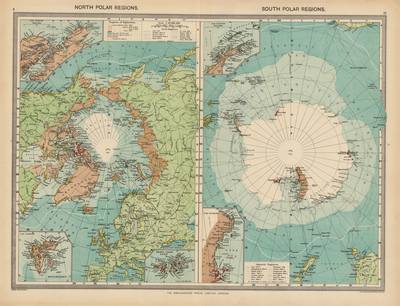
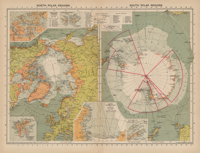
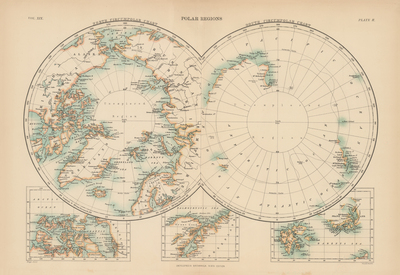
![North Polar Regions [and] South Polar Regions by George Philip & Son, The Amalgamated Press Limited, and The London Geographical Institute](https://mavmatrix.uta.edu/specialcollections_antarcticamaps/1396/thumbnail.jpg "North Polar Regions [and] South Polar Regions by George Philip & Son, The Amalgamated Press Limited, and The London Geographical Institute")
![North Polar Regions [and] South Polar Regions by George Philip & Son and The London Geographical Institute](https://mavmatrix.uta.edu/specialcollections_antarcticamaps/1399/thumbnail.jpg "North Polar Regions [and] South Polar Regions by George Philip & Son and The London Geographical Institute")


![North Polar Regions [and] South Polar Regions by John Bartholomew & Co.](https://mavmatrix.uta.edu/specialcollections_antarcticamaps/1397/thumbnail.jpg "North Polar Regions [and] South Polar Regions by John Bartholomew & Co.")
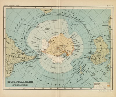
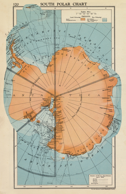
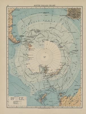
![South Polar Chart [verso] Graham Land and Queen Victoria Land by John Bartholomew & Co.](https://mavmatrix.uta.edu/specialcollections_antarcticamaps/1413/thumbnail.jpg "South Polar Chart [verso] Graham Land and Queen Victoria Land by John Bartholomew & Co.")


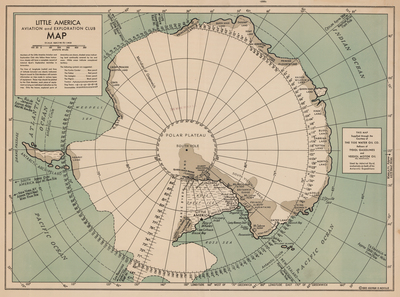
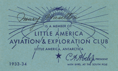
![[Little America Aviation & Exploration Club Membership Card] by Little America Aviation & Exploration Club](https://mavmatrix.uta.edu/specialcollections_antarcticamaps/1405/thumbnail.jpg "[Little America Aviation & Exploration Club Membership Card] by Little America Aviation & Exploration Club")
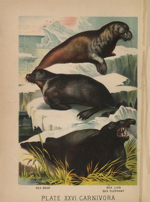
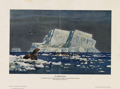
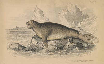
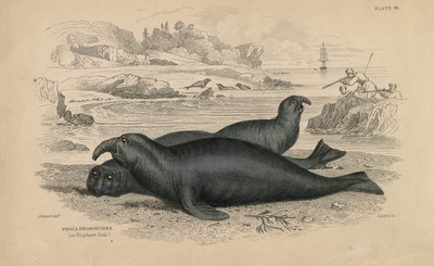
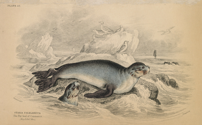
![Plate 17. Phoca Proboscidea or Sea Elephant. Female. From the Liverpool Museum [from the Naturalist's Library. Mammalia. Vol. VIII] by Liverpool Museum, William Home Lizars, Stewart, and William Jardine](https://mavmatrix.uta.edu/specialcollections_antarcticamaps/1412/thumbnail.jpg "Plate 17. Phoca Proboscidea or Sea Elephant. Female. From the Liverpool Museum [from the Naturalist's Library. Mammalia. Vol. VIII] by Liverpool Museum, William Home Lizars, Stewart, and William Jardine")

 by William Home Lizars, William Jardine, and Stewart")


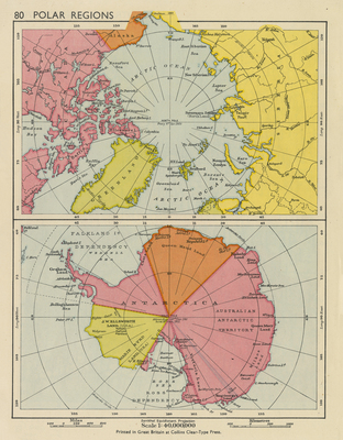
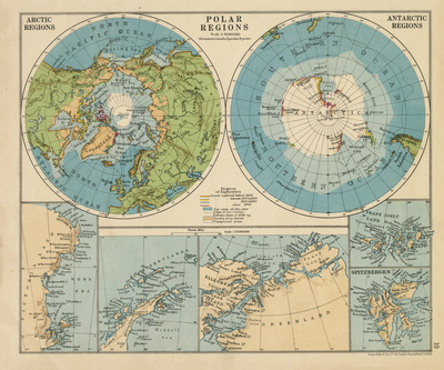
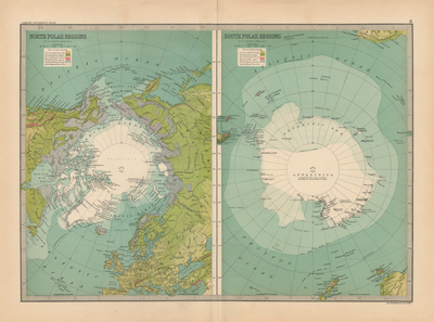
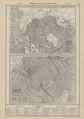
![Arctic Regions [and] Antarctic Regions by L.L. Poates Engraving Company](https://mavmatrix.uta.edu/specialcollections_antarcticamaps/1447/thumbnail.jpg "Arctic Regions [and] Antarctic Regions by L.L. Poates Engraving Company")


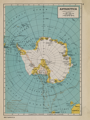
![Antarctica [Shaded Relief Map] by Muir Way and Department of the Interior, Canberra, Australia](https://mavmatrix.uta.edu/specialcollections_antarcticamaps/1460/thumbnail.jpg "Antarctica [Shaded Relief Map] by Muir Way and Department of the Interior, Canberra, Australia")


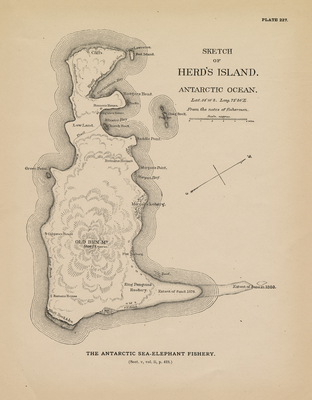
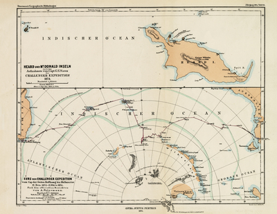
![Heard und McDonald Inseln nach den Aufnahmen von Capt. G.S. Nares Challenger Expedition 1874 [and] Kurs der Challenger Expedition vom Cap der Guten Hoffnung bis Melbourne by C. Peip, C. Hellfarth, and Justus Perthes](https://mavmatrix.uta.edu/specialcollections_antarcticamaps/1443/thumbnail.jpg "Heard und McDonald Inseln nach den Aufnahmen von Capt. G.S. Nares Challenger Expedition 1874 [and] Kurs der Challenger Expedition vom Cap der Guten Hoffnung bis Melbourne by C. Peip, C. Hellfarth, and Justus Perthes")


 by Amalgamated Press")

 by American Geographical Society")
 by American Geographical Society")
 by American Geographical Society")
 by American Geographical Society")
 by American Geographical Society")
 by American Geographical Society")


 by American Geographical Society")
 by American Geographical Society")
 by American Geographical Society")
 by American Geographical Society")
 by American Geographical Society")
 by American Geographical Society")
 by American Geographical Society")
 by American Geographical Society")
 by American Geographical Society")
 by American Geographical Society")
 by American Geographical Society")
 by American Geographical Society")
 by American Geographical Society")
 by American Geographical Society")
 by American Geographical Society")
 by American Geographical Society")
 by American Geographical Society")


 by American Geographical Society")
 by American Geographical Society")
 by American Geographical Society")
 by American Geographical Society")
 by American Geographical Society")
 by American Geographical Society")
 by American Geographical Society")
 by American Geographical Society")
 by American Geographical Society")
 by American Geographical Society")
 by American Geographical Society")
 by American Geographical Society")


 by American Geographical Society and Wolfgang Louis Gottfried Joerg")


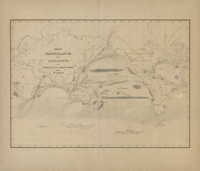
![Carta Dell' Oceano Australe Secondo R. Kiepert e traccia della Spedizione Antartica Italiana proposta da G. Bove Sott.e di Vascello [Proposed Italian Antarctic Expedition] by Giacomo Bove](https://mavmatrix.uta.edu/specialcollections_antarcticamaps/1149/thumbnail.jpg "Carta Dell' Oceano Australe Secondo R. Kiepert e traccia della Spedizione Antartica Italiana proposta da G. Bove Sott.e di Vascello [Proposed Italian Antarctic Expedition] by Giacomo Bove")


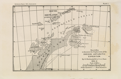
 South Polar Regions by C.S Hammond & Co.")


![[Hand-drawn Map of Antarctica] by David Finfrock](https://mavmatrix.uta.edu/specialcollections_antarcticamaps/1232/thumbnail.jpg "[Hand-drawn Map of Antarctica] by David Finfrock")
![[Hand-drawn Map of Larsen Ice Shelf] by David Finfrock](https://mavmatrix.uta.edu/specialcollections_antarcticamaps/1235/thumbnail.jpg "[Hand-drawn Map of Larsen Ice Shelf] by David Finfrock")
![[Hand-drawn Map of Ross Island, Sea, and Ice Shelf] by David Finfrock](https://mavmatrix.uta.edu/specialcollections_antarcticamaps/1180/thumbnail.jpg "[Hand-drawn Map of Ross Island, Sea, and Ice Shelf] by David Finfrock")


![South Pole Radio News [cover] by General Food Corporation](https://mavmatrix.uta.edu/specialcollections_antarcticamaps/1140/thumbnail.jpg "South Pole Radio News [cover] by General Food Corporation")


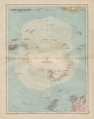
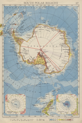
 South Polar Regions by George Philip & Son, Ltd. and The London Geographical Society")


 South Polar Regions by John Bartholomew & Co.")
 South Polar Regions by John Bartholomew & Co.")
 South Polar Regions by John Bartholomew & Co.")


![[Macrobius World Map] by Ambrosius Aurelius Theodosius Macrobius](https://mavmatrix.uta.edu/specialcollections_antarcticamaps/1273/thumbnail.jpg "[Macrobius World Map] by Ambrosius Aurelius Theodosius Macrobius")


![[Japanese World Map] by Sekisui Nagakuno](https://mavmatrix.uta.edu/specialcollections_antarcticamaps/1274/thumbnail.jpg "[Japanese World Map] by Sekisui Nagakuno")


![[North Polar Regions (and) South Polar Regions] by Rand McNally & Co](https://mavmatrix.uta.edu/specialcollections_antarcticamaps/1121/thumbnail.jpg "[North Polar Regions (and) South Polar Regions] by Rand McNally & Co")
 South Polar Regions by Rand McNally & Co")
 South Polar Regions by Rand McNally & Co")


![South Polar Regions [inset maps of Ross Sea region and surrounding continents] by Rand McNally & Co.](https://mavmatrix.uta.edu/specialcollections_antarcticamaps/1298/thumbnail.jpg "South Polar Regions [inset maps of Ross Sea region and surrounding continents] by Rand McNally & Co.")
![South Polar Regions [inset maps of Ross Sea region and surrounding continents] by Rand McNally & Co.](https://mavmatrix.uta.edu/specialcollections_antarcticamaps/1299/thumbnail.jpg "South Polar Regions [inset maps of Ross Sea region and surrounding continents] by Rand McNally & Co.")
![South Polar Regions [inset of Antarctica in relation to surrounding continents] by Rand McNally & Co.](https://mavmatrix.uta.edu/specialcollections_antarcticamaps/1297/thumbnail.jpg "South Polar Regions [inset of Antarctica in relation to surrounding continents] by Rand McNally & Co.")
![South Polar Regions [inset of Antarctica in relation to surrounding continents] by Rand McNally & Co.](https://mavmatrix.uta.edu/specialcollections_antarcticamaps/1300/thumbnail.jpg "South Polar Regions [inset of Antarctica in relation to surrounding continents] by Rand McNally & Co.")


![Antarctic Expeditions, Past and Present Some Heroes of Exploration [page 245] by Scientific American; Munn & Co., Inc.](https://mavmatrix.uta.edu/specialcollections_antarcticamaps/1146/thumbnail.jpg "Antarctic Expeditions, Past and Present Some Heroes of Exploration [page 245] by Scientific American; Munn & Co., Inc.")
![Antarctic Expeditions, Past and Present Some Heroes of Exploration [page 424] by Scientific American; Munn & Co., Inc.](https://mavmatrix.uta.edu/specialcollections_antarcticamaps/1145/thumbnail.jpg "Antarctic Expeditions, Past and Present Some Heroes of Exploration [page 424] by Scientific American; Munn & Co., Inc.")


![Nihon Nankyoku tanken-zu [Japanese Map of the Antarctic with 1957 Calendar] by Sogensha Co. Ltd.](https://mavmatrix.uta.edu/specialcollections_antarcticamaps/1193/thumbnail.jpg "Nihon Nankyoku tanken-zu [Japanese Map of the Antarctic with 1957 Calendar] by Sogensha Co. Ltd.")


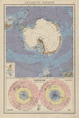
")
")
")
")
")
")
")
")
")


![[Geography Textbook page with Maps of Hemispheres and image of Explorers on the Antarctic Continent] by Unknown](https://mavmatrix.uta.edu/specialcollections_antarcticamaps/1087/thumbnail.jpg "[Geography Textbook page with Maps of Hemispheres and image of Explorers on the Antarctic Continent] by Unknown")

 South Polar Regions by Unknown")

 by Unknown")


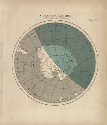
 Karte der Südpolarregion by Velhagen & Klasing")


![Антарктида [Soviet Russian Map of Antarctica] by Генеральный штаб РККА [General Staff of the Red Army]](https://mavmatrix.uta.edu/specialcollections_antarcticamaps/1230/thumbnail.jpg "Антарктида [Soviet Russian Map of Antarctica] by Генеральный штаб РККА [General Staff of the Red Army]")