


Preview
Identifier
10000759
Description
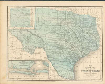
"No. 12 Map of the State of Texas, Engraved to Illustrate Mitchell's School and Family Geography," map of the state of Texas, 1858, by cartographer J. H. Young. This map includes a smaller, detailed map of "Northern Texas," and of "The Vicinity of Galveston City."
Archival Date
1858
Collection Name
Virginia Garrett Cartographic History Library
Collection Number
Acc. 125/4 00019
Original Format
Maps
File Format
JPG
Rights
Rights held by The University of Texas at Arlington Libraries, Special Collections. Any use of content downloaded or printed from this page is limited to non-commercial personal or educational use, including fair use as directed by U.S. copyright laws. For more information or for reproduction requests, please contact UTA Special Collections by emailing [email protected].
License

This work is licensed under a Creative Commons Attribution-NonCommercial 4.0 International License
Subjects
Maps; Cartography; Documents; History; Galvestone Bay; Northern Texas
Names
Young, J. H.
Subjects
Maps; Cartography; Documents; History; Galvestone Bay; Northern Texas